Wolak mountain
Woraksan Mountain
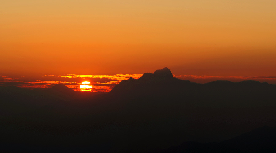
This Woraksan Mountain is called the Daemi Mountain. This is located at the boundary of Jecheon-city Ducksan-myeon and Mungyeong-city Donglo-myeon. Under this mountain, In Gyeongsang-do Myungyeong Jungpyeong-li which has 901st national road, you can go up to the top of Daemi Mountain in 1 hour 30 minutes. But in Chungcheong-do Jecheon Worak-li, Daemi Mountain is located at the far south and end of the way so you can go up to the top of this mountain in 4 hours. You had better go up to Daemi Mountain in the morning, so that you can finish hiking at the sunset. Daemi Mountain has a long ridge and a deep valley with a large land mass. Haseol Mountain (1,027.7m), Maedumak (1,099.5m), Munsubong (1,161.1m) and Daemi Mountain shows fantastic sights and these are the best sights of Jecheon. By the way, after the Korean War for several years, the North Korean Army stayed in this region of mountains and battles were fierce.
Daemi Mountain is called 'very beautiful mountain' in topographic map of 50000:1, but commonly, 'Dae' means 'Heavy color', and 'Mi' means 'Eyebrow', so 'Daemi' means 'Thick eyebrow'. If you pass 887 peaks at Yonghagok, and then go up through the ridge to Baekdudaegan, you can find the shape of soft eyebrow. This is in the shape of an eyebrow of a female.
Most of hiking at Daemi Mountain is not complete, because if you pass Haneuljae, Poamsan, Gwaneumjae, Ggokdubawibong(peak) and Burigijae, it takes many hours and you can find the last peak. Daegan Marugeum spreads out to the northern Munsubong bending once. Going down for 20 minutes Marugeum is twisted and passes Saemokjae and Chagotjae being connected to Hwangjang Mountain.
Yonghasu section (Yonghasu ∼ Peak∼ Yonghasu) Total time for hiking: 8 hours 10 minutes. Time for sections: Yonghasu rest area - (40 minutes) - Memilbong viewing point - (20 minutes) - Ggweggoribong viewing point - (1 hour) - 887 peak - (30 minutes) - Daemi mountain viewing point - (15 minutes) - Baekdudaegan 1032 peak - (35 minutes) - 1062.4 peak - (30 minutes) - Burigijae - (50 minutes) - Peak - (40 minutes) - Burigijae - (7 minutes) - Tomb - (8 minutes) - Simmani Modumteo - (1 hour) - Gangseodae, Whaledam - (4 minutes) - Suyongdam - (50 minutes) - Sunmidae - (20 minutes) - Cheongbyeokdae - (15 minutes) - Yonghasu - (5 minutes) - Yonghasu rest area The way from Jecheon to Daemi Mountain starts at Gwanpokdae parking lot passing Tambangjiwon center. Yonghagok was limited to entering because the government instructed that people should stop going to Yonghagok. If you want to pass Yonghagok, you should receive permission from the office of Woraksan Mountain .
If you park the car in the front of Yonghasu rest area and then go down to Gwanpokdae side, you can find the left woodland path before pass a large rock. This is the starting point. You should climb the steep terrain next to the right valley. Around here, you can see kinds of cowwheats and Siberian chrysanthemums. You can see Memilbong (840 m) through the gap between the branches.
If you go up for 40 minutes, you can enter the ridge of Munsubong and you can pass the pine trees and rocks. If you pass the steep uphill road for 7 minutes and then go more for 5 minutes, you can find the sign of Ggweggoribong which is tied to the branch of pine tree. But this place is 709 meters tall and different from Ggweggoribong(655.4 m) which is written on the map. Real location is different too. If you go 30 ~ 40m more and then stand on the rock, you can see Ggweggoribong. Behind Ggweggoribong, you can see Munsubong. If you want to go to Ggweggoribong and get back, it takes 30 minutes.
Left side of Munsubong, Memumak and Haseol Mountain are raised like brothers. Memumak is wide and flabby but Munsubong is sharp and Munsubong is the highest mountain of this town.
On the ridge way to Baekdudaegan many trees were fallen down because of typhoon, but some pine trees are still living and pine needles are green. At the left side of the ridge, you can see Yonghagok. Because of typhoon, sights were collapsed and had suffered.
At the point of seeing Ggweggoribong, if you go up through the ridge way for 1 hour, you can pass 887 peaks, and then you can reach 866.2 peaks. You can find the turn-off which is at the left side of 877 peaks. This turn-off is the way to descend to Whaledam. You can select the right way and go up to 866.2 peaks.
From 866.2 peaks, if you pass the steep downhill road, you can find the road which passes 7 ~ 8 ridges, and on this road, many rocks and scrubs are there. You should pass the rock and on this course, you can see Daemi Mountain and Woraksan Mountain from a distance. If you go more for 30 minutes, you can go up to Marugeum of the ridge and this section is gentle and you can walk easily. But slope with many rocks becomes steeper, and you can see mossy rocks. If you go more for 15 minutes, you can find 1032 peaks which meet Baekdudaegan.
From 1032 peaks to Daemi Mountain is 4 km. If you want to pass 1034 peaks, 1062.4 peaks and Burigijae(900m), it takes 2 hours. The way is gentle and convenient than the ridge way so you can speed up. It takes 30 minutes if you go to 1064 peaks which have Samgakjeom. From here, you can pass Ambu following Daegan Marugeum and then go to Burigijae. It takes 20 minutes. The sign which informs Burigijae, behind the sign, the signpost is fallen down.
From Burigijae, if you select the south road, you can go down to Mungyeong Joongpyeong-li Daesung Bridge. It takes 1 hour. The two ways and these are to the north. If you want to go to Yonghagok, you should select the right way and go through Sabuneungsun way and then go down to valley. If you go to Daemi Mountain, you can start from Burigijae and it takes 1 hour 10 minutes for a round-trip. On the top of Daemi Mountain, you can see Whangjang Mountain which is located at the east side and Dorak Mountain from a distance. Sobaek Mountain in Jecheon is covered with tall trees so you cannot view anything there.
If you go down from Burigijae for 10 minutes, you can pass the tombs, and if you go more for 7 ~ 8 minutes, you can find Simmani Modumteo. This is vinyl greenhouse which was installed with Korean floor heating system where 4 ~ 5 people can lie in this place. On one side, there is a rock for ancestral rite. But there are much garbage and someone threw away instant noodles to the valley water so it is awful. Urgent measures are needed acutely.
If you enter the valley, you can hear the sound of water and you can pass the forest of larches. Region of this artificial forestation is a place for slash-and-burn farmers and they cultivated the field before 1970. If you start at Burigijae and then go straight for 1 hour, you can reach Gangseodae and Whaledam. Gangseodae is a rock which looks like a pile of books. Whaledam is located at the valley under the Gangseodae.
If you go down from Whaledam for 3 ~ 4 minutes, you can find Suyongdam sign. But you cannot easily see but if you go down to the valley, you can then see Suyongdam well. And in this place, if you shower and then pray, you can give birth to a healthy son. But this is only a legend. The way from Suyongdam to Sunmidae was broken here and there so you should pass there several times.
Especially, if you pass Sunmidae, you can find big rocks which are scattered with sections of 1 km and these rocks are made by landslide. If you pass this place and then go to Cheongbyeokdae, it takes 20 minutes. From Medumak, the valley is near the Cheongbyeokdae. From Cheongbyeokdae to Yonghasu it takes 20 minutes and cars can enter this town.
[Guide point]
Hiking to Daemi Mountain is delightful because you can view Haseol Mountain, Medumak, Munsubong and Ggweggoribong and Memilbong. Also, you can step on Baekdudaegan Marugeum and this is a very pleasant thing. If you descend, you can find Yonghagok, but the government is preventing people from entering so if you want to enter, you should receive permission first. You can start at Yonghasundae and then go up to Ggwggoribong and then go down to Sunmidae or Cheongbyeokdae. You can find Ggweggoribong which can be 887 peaks in some maps, but in 50000:1 topography, you can find Ggweggoribong to have 655.4 peaks.
In Burigijae, you can find two descending ways to the north. The left way is following the 8th ridge, and this passes Neodeol section. It is connected to 1032 peaks which are raised in Baekdudaegan Marugeumsang. If you want to select the descending way to Yonghagok, you should select the right side.
If you want to hike to Daemi Mountain, you should take a rest and eat lunch and go to the peak and go down to the starting point. It takes 10 hours. Therefore, if you want to go to the peak and go down to the starting point within a day, you should start in the morning. If descending time becomes late, you should prepare a flashlight and foods. And, if you have a cellular phone, it should be turned off. Because in Daemi Mountain, you cannot call because of height.
If you cannot go down to Yonghagok because of heavy rain, you can descend from Daemi Mountain through Mungyeong Joongpyeong-li or Saengdal-li. It takes 1 hour and you can go down to 901st national road. .